| |
 |
Details: |
 |
|
|
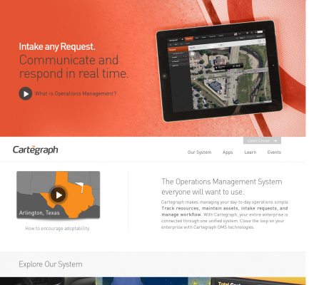
Public works and utilities software designed for maintaining transportation and water systems.
|
| URL: |
http://www.cartegraph.com/
|
| Title: |
CarteGraph :: Work Management, Asset Inventory, ESRI GIS Integration Tools |
| Image: |
 |
| Description: |
Science, Social Sciences, Geography, Geographic Information Systems - CarteGraph. Public works and utilities software designed for maintaining transportation and water systems. |
| Similar: |
|
|
|
Related Sites |
|
GIS Development (Popularity:  ): GIS content and news site with a focus towards Asia. ): GIS content and news site with a focus towards Asia.
GISuser (Popularity: ): Site delivers the latest news, feature articles, and updates concerning the use of GIS, LBS, GPS, and geospatial technologies.
Example Code (Popularity: ): Forum features information and resources related to GIS.
Center for Advanced Spatial Technologies (Popularity: ): Research center at the University of Arkansas, United States. Site contains resources for archaeologists, earth scientists and GIS specialists.
Blogmapper (Popularity: ): Blogmapper lets you associate blog entries with hot spots on a map. When you click on the spots, the entries ...
Marinamap.com (Popularity: ): Find marinas by mouseclick on the marinamap sea chart.
Nature Conservancy (Popularity: ): Provides staff and partners with GIS knowledge, systems, data, maps, and community resources. Some sections are limited to Conservancy and ...
Golf Mapping (Popularity: ): GPS service is an efficient method of gathering a complete data set of a golf course. The data set provides ...
GIS Jobs Clearinghouse (Popularity: ): Database of job openings in geographic information systems, remote sensing, and related fields.
GeoWeb Interactive (Popularity: ): Repository of job and resume postings for the GIS industry.
GISAR Project (Popularity: ): Open source GIS visualization program to created 2D,3D dynamic models of real objects.
Applet for Choropleth Maps and Cartograms (Popularity: ): A free Java applet for unclassed choropleth maps and cartograms (continous area and circle). Data: .txt, geometry: .shp and other ...
|
|
Popular Sites |
|
Satellite Imaging Corporation (Popularity: ): Provides satellite image processing from Landsat, Ikonos, Spot, QuickBird sensors and production services including digital aerial photography, digital elevation models ...
GIS Development (Popularity: ): GIS content and news site with a focus towards Asia.
3D landscape visualization for MAXON CINAMA 4D (Popularity: ): Offers wire-meshes for the rendering software MAXON CINEMA 4D taken from the GTOPO30 dataset of the U.S. Geogical Survey. Also ...
Galigeo (Popularity: ): Company provides tools for geomarketing, cartography, CRM, business intelligence.
GISCOE Web Services (Popularity: ): Cost effective Internet hosting solution for viewing geographic data via the web.
|
|
|


