 |
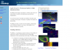
YDreams (Popularity:  ) )
http://www.ydreams.com
3D visualization solutions, specialising in spatial database-enabled interactive virtual worlds that can be displayed in PCs, interactive outdoor panels, mobile ...
|
 |
Dynamic Graphics, Inc. (Popularity: )
http://www.dgi.com/
Makers of EarthVision, a commercial 3D geospatial analysis and visualization package.
|
 |
IDV Solutions (Popularity: )
http://www.idvsolutions.com
Provides web tools and custom web solutions that enable companies to visually render, analyze and manipulate data using intuitive maps ...
|
 |
VisuMap (Popularity: )
http://www.visumap.net
A non-linear visualization program for dimensional data. It converts table of data to 2D/3D maps by combining multidimensional scaling and ...
|
 |
Spatial Online (Popularity: )
http://www.spatial-online.com/
Site for ESRI ArcView users and developers. Provides a free evaluation and secure purchase of ArcView extensions and spatial applications.
|
 |
AVPython: Python Language Support for ArcView GIS (Popularity: )
http://avpython.sourceforge.net/
Allows use of the Python programming language to customize ArcView GIS.
|
 |
Quantitative Decisions (Popularity: )
http://www.quantdec.com/
Site of Bill Huber's company, a guru in Avenue and ArcView extensions. Freeware or shareware at very reasonable prices. Mathematical ...
|
 |
Ianko's GIS page (Popularity: )
http://www.ian-ko.com/
Ianko Tchoukanski's page presenting his freeware and shareware ArcView extensions.
|
 |
Visual Learning Systems, Inc. (Popularity: )
http://www.vls-inc.com
VLS has developed the Feature Analyst as a premiere image processing tool for ESRI's ArcView and ArcGIS, which utilizes machine ...
|
 |
EZClick Tools Extension for ArcView 3.x (Popularity: )
http://raynerhoward.com/
Tool for building spatial indexes for geographic vector and raster data distributed over various directories. Helps to quickly load and ...
|
 |
Geokinectic Systems Inc. (Popularity: )
http://www.geokinetic.com/
The commercial "theEngine" extension transforms ArcView into a combination of Arc/Info and CAD.
|
 |
GeoSnap Software (Popularity: )
http://www.geosnap.com/
Offers extension to repair damaged ArcView project files. Also offers consulting services.
|
 |
MapWares (Popularity: )
http://www.mapwares.com
ArcView and ArcGIS custom tools and extensions. Upgrades from Avenue to Visual Basic.
|
 |
Hudsal (Popularity: )
http://www.husdal.com/
MFworks is raster GIS that can do vector-like network analysis.
|
 |
Charon Cemetery (Popularity: )
http://www.charoncms.com
Management Suite is mapping and management software solution for the cemetery industry
|
 |
BG-Map (Popularity: )
http://www.bg-map.com
Computer mapping software for botanical gardens and similar institutions. It links plant records stored in the BG-BASE collections management database ...
|
 |
Motherplanet (Popularity: )
http://www.motherplanet.net
Mapper software developer. Integrates high resolution satellite/topographic imagery and political boundaries, costlines, islands, lakes and lat/lon grids.
|
 |
CompassOwl (Popularity: )
http://www.compassowl.com
Developer of thematic mapping software for Macintosh.
|
 |
Biodiversity (Popularity: )
http://www.diva-gis.org
Free GIS software for biodiversity mapping.
|
 |
Synergy Program (Popularity: )
http://synergy.intergraph.com/
Family of programs by Intergraph that uses GeoMedia technology as a platform. Features white papers, forum, and online research library.
|
|


