| |
 |
Details: |
 |
|
|
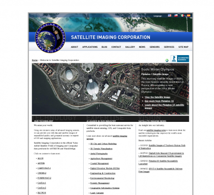
Provides satellite image processing from Landsat, Ikonos, Spot, QuickBird sensors and production services including digital aerial photography, digital elevation models (DEM), remote sensing and GIS.
|
| URL: |
http://www.satimagingcorp.com
|
| Title: |
Satellite Images and Geospatial Data for GIS & Mapping Applications |
| Image: |
 |
| Description: |
Satellite Imaging Corp provides orthorectified high resolution satellite images, DEM's for gis and mapping applications including; cadastre, environmental, oil & gas, pipeline corridors, mining, land cover, agriculture, coastal and forestry management |
| Specialized in: |
Satellite Image
-
Gis
-
Geographic Information Systems
-
Aerial Photography
-
Digital Elevation Models
-
Dem
-
Agriculture
-
Forestry
|
|
|
Related Sites |
|
GIS Development (Popularity:  ): GIS content and news site with a focus towards Asia. ): GIS content and news site with a focus towards Asia.
GISuser (Popularity: ): Site delivers the latest news, feature articles, and updates concerning the use of GIS, LBS, GPS, and geospatial technologies.
Example Code (Popularity: ): Forum features information and resources related to GIS.
Center for Advanced Spatial Technologies (Popularity: ): Research center at the University of Arkansas, United States. Site contains resources for archaeologists, earth scientists and GIS specialists.
Blogmapper (Popularity: ): Blogmapper lets you associate blog entries with hot spots on a map. When you click on the spots, the entries ...
Marinamap.com (Popularity: ): Find marinas by mouseclick on the marinamap sea chart.
Nature Conservancy (Popularity: ): Provides staff and partners with GIS knowledge, systems, data, maps, and community resources. Some sections are limited to Conservancy and ...
Golf Mapping (Popularity: ): GPS service is an efficient method of gathering a complete data set of a golf course. The data set provides ...
GIS Jobs Clearinghouse (Popularity: ): Database of job openings in geographic information systems, remote sensing, and related fields.
GeoWeb Interactive (Popularity: ): Repository of job and resume postings for the GIS industry.
Potomac Aerial Surveys, Inc. (Popularity: ): Custom Aerial Surveying Services: Digital Topographic Mapping, Aerial Photography, Photo enlargements, Ortho Imagry, Planning, Cost analysis and Implementation.
Geographic Mapping Consultants, Inc. (Popularity: ): Services include geographic information systems (GIS) consulting, data conversion, custom application development, software training, GPS data collection and professional land ...
|
|
Popular Sites |
|
Satellite Imaging Corporation (Popularity: ): Provides satellite image processing from Landsat, Ikonos, Spot, QuickBird sensors and production services including digital aerial photography, digital elevation models ...
GIS Development (Popularity: ): GIS content and news site with a focus towards Asia.
3D landscape visualization for MAXON CINAMA 4D (Popularity: ): Offers wire-meshes for the rendering software MAXON CINEMA 4D taken from the GTOPO30 dataset of the U.S. Geogical Survey. Also ...
Galigeo (Popularity: ): Company provides tools for geomarketing, cartography, CRM, business intelligence.
GISCOE Web Services (Popularity: ): Cost effective Internet hosting solution for viewing geographic data via the web.
|
|
Related Press |
|
Building a Fully Integrated Cardiovascular Imaging and Information System Webinar (Popularity: ): The University of Mississippi Medical Center and St. Peter's Hospital each implemented a suite of IT applications to equip their ...
ChemImage and Oak Ridge National Laboratories (Popularity: ): Pittsburgh, PA (ChemImage Corporation) ChemImage, a leader in Chemical Imaging technology, is pleased to announce their continuing partnership with the ...
DISH Network and EchoStar Statement Regarding TiVo (Popularity: ): DISH Network Corporation (Nasdaq: DISH) and EchoStar Corporation (Nasdaq: SATS) issued the following statement regarding recent developments in the TiVo ...
Zebra Imaging Announces 3D Geospatial Challenge (Popularity: ): AUSTIN, Texas, Feb. 16, 2012 -- Zebra Imaging, Inc., the leader in 3D holographic displays and visualization technologies, announced today ...
Country music star Clay Walker supporting MS research at UT-Houston (Popularity: ): Performance at the Houston Livestock Show and Rodeo, country music star Clay Walker presented a $100,000 check to support multiple ...
|
|
Related Articles |
|
|
|
|


