| |
 |
Details: |
 |
|
|
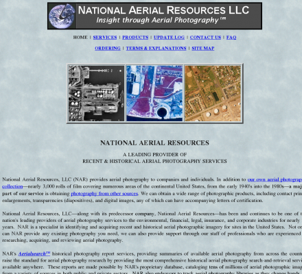
Provides aerial photography services including research and acquisition of aerial photography.
|
| URL: |
http://www.aerialsearch.net
|
| Location: |
United States - Massachusetts - Williamstown |
| Title: |
|
| Image: |
 |
| Description: |
Science, Earth Sciences, Geomatics, Photogrammetry - National Aerial Resources. Provides aerial photography services including research and acquisition of aerial photography. |
| Similar: |
|
|
|
Related Sites |
|
TerraSaurus (Popularity:  ): Specializes in GPS referenced digital aerial photography and aerial photographic interpretation. Includes sample photos, equipment, project details, publications, and company ... ): Specializes in GPS referenced digital aerial photography and aerial photographic interpretation. Includes sample photos, equipment, project details, publications, and company ...
Western Air Maps (Popularity: ): Aerial photography and photogrammetric mapping, digital and analog. Includes overview of company and services, client testimonials, employment opportunities and images.
I.F. Rooks & Associates, Inc. (Popularity: ): Aerial photography and digital photogrammetry throughout Florida and the United States.
Siradel (Popularity: ): Supplier of low and high resolution topographic data bases including 3D city models, Digital Terrain Models, land use mapping and ...
Continental Aerial Surveys (Popularity: ): Surveying and digital mapping using a variety of GPS surveying and digital imaging technologies.
Eastern Topographics (Popularity: ): Aerial photography and photogrammetric mapping services, digital and analog. Existing photography available throughout New England, including the entire state of ...
Offset Services Limited (Popularity: ): Photogrammetry, as-built computer models, and CAD from survey data.
LaFave White & McGivern LS PC (Popularity: ): Land Surveying and Photogrammetric Mapping
Base Mapping (Popularity: ): Provide mapping services such as digital terrain analysis, orthophotos, photogrammetry, aerial photography and scanning working with public, private and government ...
Airborne 1 Corporation (Popularity: ): Operates across the United States with Lidar technology to create digital maps for land surveying firms.
Blimp Photo Services (Popularity: ): Our BLIMPCAMSystem produces very low altitude and close-range perspectives beyond helicopter capabilities in dense urban areas. We have developed a ...
Aero Geometrics (Popularity: ): Aerial survey and digital mapping.
|
|
Popular Sites |
|
National Aerial Resources (Popularity: ): Provides aerial photography services including research and acquisition of aerial photography.
DAT/EM Systems International (Popularity: ): Software for digital mapping and photogrammetry.
Ace Aerial Photography, Inc (Popularity: ): Aerial photography, topographic mapping and digital orthophotos services along with a large inventory of historical aerial negatives.
Environmental Remote Sensing Center (Popularity: ): Remote Sensing and Digital Photogrammetry. Chairs: Dr. Thomas Lillesand and Dr. Frank Scarpace.
MAN Mapping Services Home (Popularity: ): Topographic mapping, GIS base data and digital orthophoto imagery services under the supervision of Larry Mumford and Bob Niepert.
|
|
Related Press |
|
American Farmer to Showcase Air Tractor in Upcoming Episode on RFD-TV (Popularity: ): Olney, TX - November 25, 2014 -- Air Tractor, Inc. announced that they will be featured in an upcoming episode ...
Aerialforce Comment on UK's State of Preparation for Digital Switchover (Popularity: ): United Kingdom, 14 February, 2011 - Aerialforce, a leading UK supplier of satellite, home entertainment, digital aerial installations and services, ...
Speaker to Address Michigan Conference on Affordable Housing Regarding National Affordable Housing Trust Fund (Popularity: ): Ed Gramlich, Director of Outreach for the National Low Income Housing Coalition will address participants at the Michigan Conference on ...
Students Can Learn More About Their College Options at the Free Philadelphia National College Fair (Popularity: ): As the process of applying to and selecting a college becomes more and more competitive and complex, students and parents ...
VHT Studios® Acquires Real Estate Photography Business from Circlepix® (Popularity: ): ROSEMONT, Ill. - January 05, 2018 -- VHT Studios®, the nation’s leading provider of professional photography, virtual staging and visual ...
|
|
Related Articles |
|
Has Google Earth Destroyed the Aerial Photography Business? (Popularity: ): Google Earth is a great resource, and yet one of the most controversial things online. Mostly due to the fact ...
Free Help With Foreclosure (Popularity: ): There are many free resources out there to help with foreclosure. There are just as many scams so be careful ...
Creating an Orthophoto / Orthorectification (Popularity: ): In the areas of Geomatics data acquisition, visualization and general mapping,
digital satellite imagery and aerial photographs have a significant ...
National Sheds (Popularity: ): National Sheds is a proud 100% Australian owned company and our products are made from 100% Australian Bluescope Steel.We produce ...
Malta Air Show Boosts Hotel Bookings (Popularity: ): Malta's annual international air show is set to be the best ever this year, with tens of thousands of islanders ...
|
|
|


