| |
 |
Details: |
 |
|
|
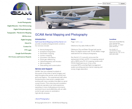
Aerial photography, topographic mapping and digital orthophotos services along with a large inventory of historical aerial negatives.
|
| URL: |
http://www.aceaerialphoto.com/
|
| Title: |
GCAM Aerial Mapping - Home |
| Image: |
 |
| Description: |
Science, Earth Sciences, Geomatics, Photogrammetry - Ace Aerial Photography, Inc. Aerial photography, topographic mapping and digital orthophotos services along with a large inventory of historical aerial negatives. |
| Similar: |
|
|
|
Related Sites |
|
Environmental Remote Sensing Center (Popularity:  ): Remote Sensing and Digital Photogrammetry. Chairs: Dr. Thomas Lillesand and Dr. Frank Scarpace. ): Remote Sensing and Digital Photogrammetry. Chairs: Dr. Thomas Lillesand and Dr. Frank Scarpace.
Inpho (Popularity: ): Supplier of systems for aerial triangulation, DTM modeling, image matching, and feature extraction
DAT/EM Systems International (Popularity: ): Software for digital mapping and photogrammetry.
TerraServer (Popularity: ): Online subscription service providing access to a database of high resolution satellite and overhead imagery from all over the world.
MAN Mapping Services Home (Popularity: ): Topographic mapping, GIS base data and digital orthophoto imagery services under the supervision of Larry Mumford and Bob Niepert.
GeoLas Consulting (Popularity: ): Provides consulting services for imaging laser altimetry/airborne laser mapping technology and applications, and 3D geodata processing and visualization services.
LaFave White & McGivern LS PC (Popularity: ): Land Surveying and Photogrammetric Mapping
Cartwright Aerial Surveys, Inc. (Popularity: ): Photogrammetric services including aerial photography, digital topographic mapping, orthophotography, and digital terrain modeling.
National Aerial Resources (Popularity: ): Provides aerial photography services including research and acquisition of aerial photography.
Aero Geometrics (Popularity: ): Aerial survey and digital mapping.
Base Mapping (Popularity: ): Provide mapping services such as digital terrain analysis, orthophotos, photogrammetry, aerial photography and scanning working with public, private and government ...
TerraSaurus (Popularity: ): Specializes in GPS referenced digital aerial photography and aerial photographic interpretation. Includes sample photos, equipment, project details, publications, and company ...
|
|
Popular Sites |
|
National Aerial Resources (Popularity: ): Provides aerial photography services including research and acquisition of aerial photography.
DAT/EM Systems International (Popularity: ): Software for digital mapping and photogrammetry.
Ace Aerial Photography, Inc (Popularity: ): Aerial photography, topographic mapping and digital orthophotos services along with a large inventory of historical aerial negatives.
Environmental Remote Sensing Center (Popularity: ): Remote Sensing and Digital Photogrammetry. Chairs: Dr. Thomas Lillesand and Dr. Frank Scarpace.
MAN Mapping Services Home (Popularity: ): Topographic mapping, GIS base data and digital orthophoto imagery services under the supervision of Larry Mumford and Bob Niepert.
|
|
Related Press |
|
Four Ace Electrical Services Corp Offers Career Opportunity in Sacramento, CA (Popularity: ): Sacramento, California- February 11, 2013-To accommodate the increasing demand for their commercial, industrial, and home electrical services in Sacramento and ...
VHT Studios® Acquires Real Estate Photography Business from Circlepix® (Popularity: ): ROSEMONT, Ill. - January 05, 2018 -- VHT Studios®, the nation’s leading provider of professional photography, virtual staging and visual ...
Adobe ACE Photoshop CS2 Certification: New Practice Test for Exam 9A0-044 by uCertify (Popularity: ): uCertify, a provider of exam preparation software for Adobe certifications, has announced that the practice test for Adobe Photoshop ACE ...
Exam 9A0-044: Adobe ACE Photoshop CS 2 Practice Test launched by uCertify (Popularity: ): uCertify (May 22, 2007) uCertify, a leading provider of practice exams and preparation software for Adobe certifications, has released its ...
BetterPhoto.com® Announces New Feature (Popularity: ): A new feature from BetterPhoto.com® now makes it much easier to learn photography or Photoshop over the course of one ...
|
|
Related Articles |
|
|
|
|


