| |
 |
Details: |
 |
|
|
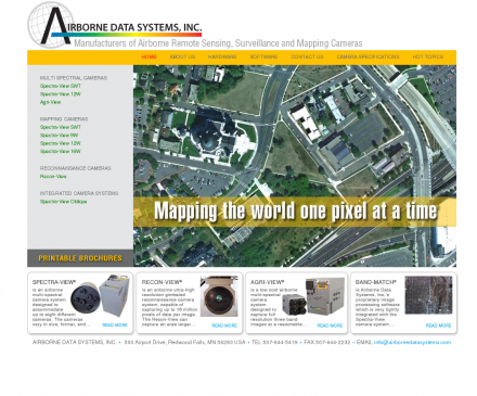
Manufactures an airborne multi-spectral digital imaging system that integrates differential GPS and an inertial measurement unit (IMU) to provide georeferenced digital images in a spectral range from visual to thermal infrared.
|
| URL: |
http://www.airbornedatasystems.com/
|
| Title: |
|
| Image: |
 |
| Description: |
Science, Earth Sciences, Geomatics, Remote Sensing - Airborne Data Systems. Manufactures an airborne multi-spectral digital imaging system that integrates differential GPS and an inertial measurement unit (IMU) to provide georeferenced digital images in a spectral range from visual to thermal infrared. |
| Similar: |
|
|
|
Related Sites |
|
InfraMation - The Thermographers Conference (Popularity:  ): Annual conference to be held September 29 through October 2 in Orlando, Florida, for infrared camera users and thermographers involved ... ): Annual conference to be held September 29 through October 2 in Orlando, Florida, for infrared camera users and thermographers involved ...
Epsilon Nought - Radar Remote Sensing (Popularity: ): Epsilon nought gives an introduction into radar remote sensing and related problems with tutorials, excercises, demo data sets as well ...
Earthnet Online (Popularity: ): Earth Observation Data from the European Space Agency.
Landsat 7 (Popularity: ): United States Geological Survey (USGS): Landsat 7 satellite images.
Earth Search (Popularity: ): Hyperspectral imaging technology by Earth Search offers a powerful economic tool for mineral exploration and environmental research.
Spectral Imaging, Ltd. (Popularity: ): Develops and produces market imaging spectrometry instrumentation for industrial machine vision and spectral analysis, airborne remote sensing and scientific applications.
MacDonald Dettwiler (MDA) (Popularity: ): Plays active role in virtually every phase of information delivery, from Earth observation satellite missions and space-borne communications to ground ...
GER Proprietary Systems (Popularity: ): Airborne, portable, radar, and space technologies.
TerraSystems, Inc. (Popularity: ): Earth and planetary remote sensing for environmental monitoring, land use, and resource management.
ASD: Welcome to Analytical Spectral Devices, Inc. (Popularity: ): Details of an instrument which is aboard the Terra (EOS AM-1) satellite that is viewing the entire Earth's surface every ...
Worldsat International (Popularity: ): Publisher and producer of consumer based products from satellite imagery.
Vexcel Corporation (Popularity: ): International remote sensing company with technical areas of expertise including synthetic aperture radar, satellite data processing and ground stations, mapping, ...
|
|
Popular Sites |
|
InfraMation - The Thermographers Conference (Popularity: ): Annual conference to be held September 29 through October 2 in Orlando, Florida, for infrared camera users and thermographers involved ...
Epsilon Nought - Radar Remote Sensing (Popularity: ): Epsilon nought gives an introduction into radar remote sensing and related problems with tutorials, excercises, demo data sets as well ...
Earth Search (Popularity: ): Hyperspectral imaging technology by Earth Search offers a powerful economic tool for mineral exploration and environmental research.
Top Scene Rehearsal and Simulation Systems (Popularity: ): Software from Lockheed Martin Missiles and Fire Control that produces the Tactical Operational Scene (TOPSCENE) mission rehearsal system for the ...
Landsat 7 (Popularity: ): United States Geological Survey (USGS): Landsat 7 satellite images.
|
|
Related Press |
|
|
Related Articles |
|
The Path of the 1994 Aries Aircraft (Popularity: ): The name Aries is not an unfamiliar word in aeronautical research, originally referred to as the Airborne Research Integrated Experiments ...
Healing the World: Telemetry Systems (Popularity: ): Telemetry, derived from the Greek words, tele meaning remote, and metron meaning measure, is the technology of automatic measurement and ...
Data recovery reviews (Popularity: ): Technology provides data recovery software to restore lost photos, images and data files from corrupted media drive.
A-10 Thunderbolt Gets Thumbs Up (Popularity: ): During a ceremony in Langley Air Force Base, Vancouver, the precision engagement modified A-10C Thunderbolt II received its Initial Operational ...
data recovery software download (Popularity: ): A library of data recovery software for lost data retrieval as well as data security software such as keylogger.
|
|
|


