| |
 |
Details: |
 |
|
|
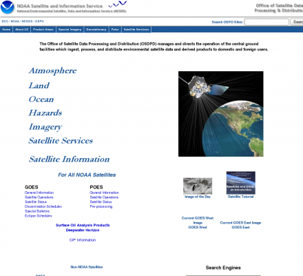
Graphical presentation from the US Government National Environment Satellite, Data, and Information Service. Includes charts for sea surface temperatures, aerosol optical thickness, coral bleaching hotspots, precipitation, volcanic ash, and a snow and ice mapping system.
|
| URL: |
http://www.osdpd.noaa.gov/
|
| Title: |
Office of Satellite Data Processing and Distribution Home Page Redirect |
| Image: |
 |
| Description: |
Science, Environment, Global Change, Impacts and Indicators - Office of Satellite Data Processing and Distribution (OSDPD). Graphical presentation from the US Government National Environment Satellite, Data, and Information Service. |
| Similar: |
|
|
|
Related Sites |
|
Global Change Data and Information System (GCDIS) (Popularity:  ): A collection of distributed information systems operated by government agencies involved in global change research. Includes multidisciplinary data from atmospheric ... ): A collection of distributed information systems operated by government agencies involved in global change research. Includes multidisciplinary data from atmospheric ...
The Threat of Global Warming (Popularity: ): Provides an broad overview of the subject, including notes on diverse environmental topics and links to brief essays about threatened ...
Arctic Climate Impact Assessment (Popularity: ): A project of the Arctic Council and the International Arctic Science Committee (IASC), to evaluate and synthesize knowledge of the ...
Global Warming Map: Early Warning Signs (Popularity: ): Illustrates observed consequences, as indicated by periods of unusually warm weather, coastal flooding, and changes in glaciers and polar regions.
Global Change and Terrestrial Ecosystems (GCTE) Project (Popularity: ): Information from an International Geosphere-Biosphere Program (IGBP) core project for research on responses to rising carbon dioxide levels and other ...
UK Climate Impacts Programme (Popularity: ): Assessing the likely environmental and economic effects of climate change in the UK. Includes background information, research, research tools and ...
|
|
Popular Sites |
|
UK Climate Impacts Programme (Popularity: ): Assessing the likely environmental and economic effects of climate change in the UK. Includes background information, research, research tools and ...
Global Change and Terrestrial Ecosystems (GCTE) Project (Popularity: ): Information from an International Geosphere-Biosphere Program (IGBP) core project for research on responses to rising carbon dioxide levels and other ...
Global Warming Map: Early Warning Signs (Popularity: ): Illustrates observed consequences, as indicated by periods of unusually warm weather, coastal flooding, and changes in glaciers and polar regions.
Arctic Climate Impact Assessment (Popularity: ): A project of the Arctic Council and the International Arctic Science Committee (IASC), to evaluate and synthesize knowledge of the ...
The Threat of Global Warming (Popularity: ): Provides an broad overview of the subject, including notes on diverse environmental topics and links to brief essays about threatened ...
|
|
Related Press |
|
Rentrak Announces Official Box Office Totals for Weekend of May 13, 2011 (Popularity: ): LOS ANGELES, May 15, 2011 -- Rentrak Corporation (Nasdaq: RENT), today announced the official weekend theatrical box office numbers for ...
Rentrak Announces Official Box Office Numbers for Weekend of September 9, 2011 (Popularity: ): LOS ANGELES, Sept. 11, 2011 -- Rentrak Corporation (Nasdaq: RENT), today announced the official weekend theatrical box office numbers for ...
Rick Dees Launched Into Outer Space (Popularity: ): Rick Dees and XM Satellite Radio have reached an agreement that will make every show from The Rick Dees Weekly ...
Rentrak Announces Official Box Office Totals for Weekend of June 25, 2010 (Popularity: ): Rentrak Corporation (Nasdaq: RENT), today announced the official weekend theatrical box office numbers for the weekend period of June 25 ...
Minecode Corp. Announces Release of LiDAR-M Data Processing Software (Popularity: ): Minecode Corporation, a provider of software and product development solutions for enterprise businesses, announces the release of LiDAR-M version 3.2, ...
|
|
Related Articles |
|
|
|


