| |
 |
Details: |
 |
|
|
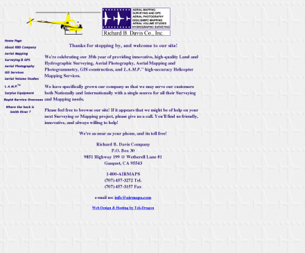
Land and hydrographic surveying, aerial photography, mapping and photogrammetry, GIS Construction and high-accuracy helicopter mapping services.
|
| URL: |
http://www.airmaps.com/
|
| Title: |
Richard B. Davis Company, Inc. - Aerial Photography, Air Mapping, Surveying, GPS, GIS, Aerial Volume studies, L.A.M.P. |
| Image: |
 |
| Description: |
Aerial Photography, Air Mapping, Surveying, GPS, GIS, Aerial Volume studies, and L.A.M.P. |
| Similar: |
|
|
 |
Related Sites |
 |
Environmental Remote Sensing Center (Popularity:  ): Remote Sensing and Digital Photogrammetry. Chairs: Dr. Thomas Lillesand and Dr. Frank Scarpace. ): Remote Sensing and Digital Photogrammetry. Chairs: Dr. Thomas Lillesand and Dr. Frank Scarpace.
Inpho (Popularity:  ): Supplier of systems for aerial triangulation, DTM modeling, image matching, and feature extraction ): Supplier of systems for aerial triangulation, DTM modeling, image matching, and feature extraction
DAT/EM Systems International (Popularity:  ): Software for digital mapping and photogrammetry. ): Software for digital mapping and photogrammetry.
TerraServer (Popularity:  ): Online subscription service providing access to a database of high resolution satellite and overhead imagery from all over the world. ): Online subscription service providing access to a database of high resolution satellite and overhead imagery from all over the world.
MAN Mapping Services Home (Popularity:  ): Topographic mapping, GIS base data and digital orthophoto imagery services under the supervision of Larry Mumford and Bob Niepert. ): Topographic mapping, GIS base data and digital orthophoto imagery services under the supervision of Larry Mumford and Bob Niepert.
GeoLas Consulting (Popularity:  ): Provides consulting services for imaging laser altimetry/airborne laser mapping technology and applications, and 3D geodata processing and visualization services. ): Provides consulting services for imaging laser altimetry/airborne laser mapping technology and applications, and 3D geodata processing and visualization services.
LaFave White & McGivern LS PC (Popularity:  ): Land Surveying and Photogrammetric Mapping ): Land Surveying and Photogrammetric Mapping
Cartwright Aerial Surveys, Inc. (Popularity:  ): Photogrammetric services including aerial photography, digital topographic mapping, orthophotography, and digital terrain modeling. ): Photogrammetric services including aerial photography, digital topographic mapping, orthophotography, and digital terrain modeling.
National Aerial Resources (Popularity:  ): Provides aerial photography services including research and acquisition of aerial photography. ): Provides aerial photography services including research and acquisition of aerial photography.
Aero Geometrics (Popularity:  ): Aerial survey and digital mapping. ): Aerial survey and digital mapping.
Survey 2 CAD (Popularity:  ): Specialize in the production of 3D as-built CAD models using close range digital photogrammetry and PICS technology. ): Specialize in the production of 3D as-built CAD models using close range digital photogrammetry and PICS technology.
Offset Services Limited (Popularity:  ): Photogrammetry, as-built computer models, and CAD from survey data. ): Photogrammetry, as-built computer models, and CAD from survey data.
|
 |
Popular Sites |
 |
National Aerial Resources (Popularity:  ): Provides aerial photography services including research and acquisition of aerial photography. ): Provides aerial photography services including research and acquisition of aerial photography.
DAT/EM Systems International (Popularity:  ): Software for digital mapping and photogrammetry. ): Software for digital mapping and photogrammetry.
Ace Aerial Photography, Inc (Popularity:  ): Aerial photography, topographic mapping and digital orthophotos services along with a large inventory of historical aerial negatives. ): Aerial photography, topographic mapping and digital orthophotos services along with a large inventory of historical aerial negatives.
Environmental Remote Sensing Center (Popularity:  ): Remote Sensing and Digital Photogrammetry. Chairs: Dr. Thomas Lillesand and Dr. Frank Scarpace. ): Remote Sensing and Digital Photogrammetry. Chairs: Dr. Thomas Lillesand and Dr. Frank Scarpace.
MAN Mapping Services Home (Popularity:  ): Topographic mapping, GIS base data and digital orthophoto imagery services under the supervision of Larry Mumford and Bob Niepert. ): Topographic mapping, GIS base data and digital orthophoto imagery services under the supervision of Larry Mumford and Bob Niepert.
|
 |
Related Press |
 |
Mapping Company Educates Readers On Sales Territory Mapping (Popularity:  ): Wake Forest, North Carolina (press.abc-directory) March 26, 2020 - Geographic Enterprises, a North Carolina mapping company, recently discussed the importance ... ): Wake Forest, North Carolina (press.abc-directory) March 26, 2020 - Geographic Enterprises, a North Carolina mapping company, recently discussed the importance ...
Sales Territory Mapping Company Educates On Sales Territory Management (Popularity:  ): Wake Forest, North Carolina ( press.abc-directory.com ) September 1, 2020 - Geographic Enterprises, a sales territory mapping company, has recently ... ): Wake Forest, North Carolina ( press.abc-directory.com ) September 1, 2020 - Geographic Enterprises, a sales territory mapping company, has recently ...
Afeni Shakur-Davis and Family Extend Gratitude Concerning Fire Last Night (Popularity:  ): Ms. Afeni Shakur-Davis and her family would like to extend their gratitude and thanks to everyone for the kindness and ... ): Ms. Afeni Shakur-Davis and her family would like to extend their gratitude and thanks to everyone for the kindness and ...
Mapping Company Discusses Sales Mapping Software for the Insurance Industry (Popularity:  ): Wake Forest, North Carolina ( press.abc-directory.com ) April 29, 2020 - Mapping Resources, a North Carolina sales mapping software company, ... ): Wake Forest, North Carolina ( press.abc-directory.com ) April 29, 2020 - Mapping Resources, a North Carolina sales mapping software company, ...
Idea Mapping: How to Access Your Hidden Brain Power, Learn Faster, Remember More, and Achieve Success in Business By Jamie Nast (Popularity:  ): In this busy world, we're constantly asked to do more in less time. But how do you cope with the ... ): In this busy world, we're constantly asked to do more in less time. But how do you cope with the ...
|
 |
Related Articles |
 |
|
|
|
